WASHINGTON – NASA will track hurricanes with its newest small satellite constellation – the first with an Earth science mission.
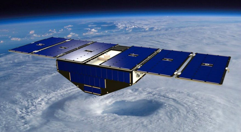
Data collected by the Cyclone Global Navigation Satellite System, a collection of eight micro-satellites, will help scientists track storms, as well as predict their intensity. CYGNSS data is also expected to improve storm surge forecasts.
The system, set to launch from Cape Canaveral Air Force Station next month, will be carried into space by a Pegasus XL rocket, according to the UPI.
The CYGNSS mission is a partnership between National Aeronautics and Space Administration (NASA), the University of Michigan and the Southwest Research Institute.
Current hurricane-tracking satellite systems struggle to measure the insides of hurricanes – the action at the center. The heaviest rains obscure the vision of satellite instruments. The eight micro-satellites will use new GPS technology and analysis techniques to better predict what exactly is going on beneath the rain.

“Today, we can’t see what’s happening under the rain,” Chris Ruf, a principal investigator on the CYGNSS mission and a professor of climate and space sciences at the University of Michigan, said in a news release. “We can measure the wind outside of the storm cell with present systems, but there’s a gap in our knowledge of cyclone processes in the critical eyewall region of the storm
Experimental models currently do their best to guess, but their predictions are without enough quality data. CYGNSS aims to fill the data gap.
The eight satellites can make measurements more frequently and from different angles. Together, the constellation can record 32 ocean surface wind measurements per second. The faster flow of more revealing data will make prediction models more accurate.


