
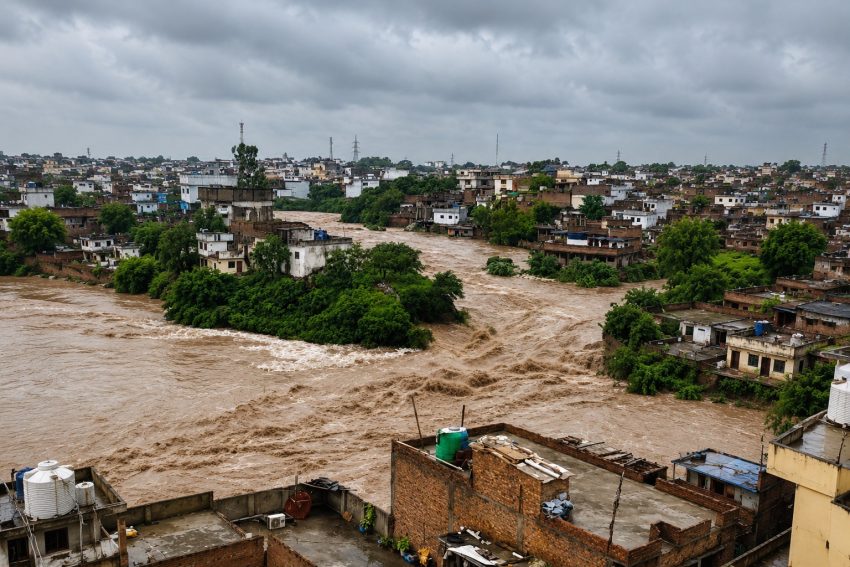
On 17 July 2025, sirens went off along the banks of Nala Lai as its water rose to 22 feet at Kattarian Bridge and 19 feet at Gawalmandi. Homes and shops in Dhok Khaba, Pirwadhai, Amarpura, Sadiqabad, Arya Mohalla and Bohar Bazaar took in two to three feet of water. More than a hundred students were evacuated from a madrasa in Saddar. A cemetery wall collapsed in the cantonment. The district administration declared an emergency, WASA declared its own rain emergency, and Rawalpindi asked the army for help. Six weeks later, on 2 September, it happened again, water climbing to within a foot of the same danger marks.
None of this was unprecedented. It was, in fact, routine, a channel behaving exactly as it has for decades, in a city that keeps building as though it won’t.
What Nala Lai actually is
Nala Lai is a natural, rain-fed stream, not a drain built by any single authority, but a watercourse shaped by the land itself. It gathers runoff from the Margalla Hills and carries it from Islamabad into Rawalpindi before emptying into the Soan River. Its full catchment covers roughly 235 square kilometres across both cities.
Three hill streams, Saidpur Kas, Tanawali Kas and Badrawali Kas, carry Islamabad’s share of that water down to meet the main channel near Kattarian Bridge. From there, inside Rawalpindi, it joins Nikki Lai, Pir Wadhai Kas, Dhok Ratta, and a web of smaller drains, each adding volume as the channel pushes on toward the Soan. It is, in other words, an entire catchment system disguised as a single nullah, and what falls on Margalla in an hour can appear in Rawalpindi’s low-lying streets soon after.
A history that keeps repeating
The channel’s worst-known disaster remains 23 July 2001, when Islamabad recorded roughly 620 millimetres of rain in about ten hours. Nala Lai and its tributaries rose faster than the city could react. Seventy-four people died, close to 400,000 were affected, and around 3,000 homes were destroyed or damaged, with losses running into billions of rupees.
More than two decades on, the pattern has not broken; it has simply repeated itself, almost annually, at a smaller scale, with the same low-lying neighbourhoods, the same sirens, the same evacuations. What has changed is the city around the channel, and that is precisely the problem.
A second front: what happens upstream
Nala Lai’s collapse is not only a story about what has been built inside its own floodway. During one of Rawalpindi’s most severe recent flooding episodes, Rawal Dam, further upstream in Islamabad, reached capacity after heavy rain, and its operators opened the spillways, releasing a large volume of water that, combined with the flow from Nullah Korang, entered the River Soan on the same day Rawalpindi was flooding.
Some Rawalpindi residents and civic groups have since raised a pointed question: whether that release reduced the Soan’s capacity to absorb Nala Lai’s own floodwater at the same time, effectively pushing water back up the channel and into the city’s drainage network. Floodwater from Nala Lai and roughly fifteen connected rainwater drains went on to inundate major commercial and residential areas, including Raja Bazaar, Fawara Chowk, Moti Bazaar, Bara Bazaar, Dingi Khoi Chowk, Jamia Masjid Road, College Road and Naya Mohalla.
That specific claim, that the timing of an upstream dam release affected a downstream city’s ability to drain its own floodwater, is not yet independently confirmed, and it deserves the same scrutiny this piece has applied to encroachment. But it points to a structural weak spot that sits alongside all the others: the Soan catchment spans two cities, and at least two dam and drainage authorities, and no public evidence shows that spillway timing at Rawal Dam is coordinated in real time with flood risk downstream in Rawalpindi. Whether this specific release worsened this specific flood, the absence of a shared, transparent protocol for this kind of decision is a governance gap in its own right.
A catchment built to fail
Nala Lai floods quickly for a simple hydrological reason: its upper catchment is steep, and Margalla’s rain reaches the valley floor in a matter of hours, sometimes without needing days of sustained rainfall to do damage. But the speed of the water is only half the story. The other half is what has been allowed to happen to its path as it moves down.
Islamabad and Rawalpindi have expanded rapidly over the past two decades, and much of that growth has paid little attention to the ground it was built on. Housing societies have gone up along the Margalla foothills and across the wider catchment with minimal provision for stormwater drainage, retention ponds or rainwater harvesting, the basic infrastructure that lets a fast-growing city absorb a downpour instead of simply forwarding it downstream. Tree cover on the hills, which once slowed runoff and let water soak into the soil, has thinned under the pressure of construction and quarrying, so more rain now arrives as immediate flow rather than delayed seepage.
Then there is the encroachment itself: land within the nullah’s natural floodway sold, subdivided and built on for profit, sometimes with the tacit cooperation, locally described as “mili-bhagat,” of the very departments meant to prevent it. Waterways inside several housing societies have been narrowed to fractions of their original width; in places, they have been closed off entirely, with structures, shops and even plazas standing where a channel used to run. Regulators, including the Capital Development Authority, Rawalpindi Development Authority, Municipal Corporation, and local building control authorities, have the legal mandate to stop this. In practice, enforcement has arrived unevenly and after the fact, often only once a flood makes the encroachment impossible to ignore. The Rawalpindi Development Authority’s anti-encroachment drive along the nullah’s banks in August 2025, targeting sites near Kattarian, Dhok Naju, Sheikh Rashid Bridge, and Gawalmandi under a zero-tolerance directive from the Punjab government, shows the problem is being taken seriously. It is also, twenty-four years after 2001, a sign of how long it has been allowed to grow.
The pattern repeats, one nullah at a time
Nala Lai is not an isolated case, and the clearest proof of that comes from CDA’s own paperwork. When roughly 150 millimetres of rain flooded Islamabad’s E-11 sector, Park Road near Comsats and Ghauri Town, an investigation by Dawn traced the damage back to the same cause: smaller nullahs squeezed by exactly the same process, often with the authority’s own signature on the approval.
In E-11, a private housing society reduced one nullah from 40 feet to 18 feet to create saleable plots, with CDA’s own permission to cover the channel. Just before entering the sector, that same nullah had close to 100 feet of right-of-way; inside it, that fell to roughly 18 feet, with a sharp bend built into the design- a permanent bottleneck that meets a second squeezed nullah entering from E-10. This is the sector where a mother and child died in the 2021 floods; this time, further deaths were avoided only because the administration had already sealed the houses judged to be at risk.
Near Park Road, satellite images from 2005 and 2026 show Gumrah Kas rerouted well away from its original course, once through private land, now through land CDA itself had acquired, with the vacated stretch of the old channel handed over for housing. At Ghauri Town, an unauthorised housing society sits astride two natural nullahs, both squeezed for construction. And at Lohi Bher, one of the city’s lowest-lying points, the 1960 master plan had set aside land for a lake, built specifically to store floodwater. CDA never acquired that land. Two private housing schemes occupy the site today.
None of this happened by accident. In the 1990s, CDA amended its own master plan to reclassify Zone 4 from green area to residential, opening the door to the very housing schemes now sitting on former floodways and a long-abandoned reservoir alike. Islamabad has lost 14 hectares of tree cover since 2001, according to Global Forest Watch. Each of these decisions, taken alone, could be defended as a minor exception. Taken together, they explain why a carefully planned capital now floods like a city that was never planned at all.
Jab paani ka raasta roka jaaye
It happens at Nala Lai. It happens at Gumrah Kas, at E-11, at Ghauri Town. It even happened at Lohi Bher before a single drop of rain fell there, in the shape of a lake that authorities never let exist. An old saying fits it all better than any engineering report: block water’s path, and it will make one of its own. It does not check whose house stands in the way, whose plaza, whose land. It simply carries off whatever it finds there.
That is the physics of a floodplain, stated as folk wisdom. A watercourse encroached upon does not disappear; it is only deferred, and it returns, without warning, to reclaim exactly the space it was denied. Every wall raised inside the natural channel, every shop built over a stormwater path, is a debt against a future flood. Nature does not forgive that debt. It collects it, usually at the worst possible moment, and it does not distinguish between a family home and a commercial plaza when it does.
There may be short-term money in filling a waterway and building on it, in cutting a hillside for one more housing plot, in looking away from a violation for the right price. But playing games with a river’s own path is, in the end, playing games with the safety of everyone downstream, including, eventually, the people who profited from it. The 2001 flood, and every smaller flood since, is the bill for exactly that kind of short-term thinking.
What it would take to break the cycle
The good news is that Nala Lai’s problem is well understood, and much of the fix is not exotic engineering; it is discipline and enforcement applied consistently over time.
Treat the catchment as one system, not several jurisdictions. CDA, RDA, WASA, the Municipal Corporation and the cantonment boards each control a piece of the channel. A single, empowered catchment authority, with the mandate to plan, permit and enforce across the entire 235 square kilometres, would close the gaps that individual agencies currently leave for encroachment to slip through.
Make the floodway legally and physically unbuildable. A surveyed, marked and permanently protected right-of-way along Nala Lai and its tributaries, with real penalties and demolition rather than warnings for violations, would stop new encroachment before it hardens into a building that is politically costly to remove.
Require new housing societies to manage their own water. Retention ponds, detention basins and mandatory rainwater harvesting should be a condition of approval for any development in the catchment, not an afterthought. A society that stores and slows its own runoff takes pressure off the channel every other resident depends on.
Restore the hills that used to do this job for free. Reforestation and erosion control on the Margalla foothills, alongside a real limit on quarrying and hillside cutting, would slow the runoff at its source rather than leaving the city to manage it after the fact.
Invest in warning systems people can act on. The sirens at Kattarian and Gawalmandi work, but they warn people minutes before a flood, not days. Better upstream rainfall monitoring, paired with a public alert system tied to specific neighbourhoods, would give residents real time to move.
Break the incentive for collusion. Anti-encroachment drives that follow a flood and then fade until the next one will not hold. Independent oversight of the departments responsible for enforcement, transparent land records for the catchment, and real consequences for officials who approve construction inside a floodway are what turn a one-off operation into a lasting deterrent.
Coordinate upstream and downstream flood operations. Reservoir releases at Rawal Dam and drainage decisions in Rawalpindi currently appear to happen without a shared, real-time protocol between the agencies involved. A joint operating procedure for the Soan catchment, agreed and tested before the monsoon rather than improvised during it, would prevent flood relief in one city from becoming flood risk in another, and would let both sides answer the coordination question with evidence rather than speculation.
A test case is already underway
Some of this is now promised on paper. CDA Chairman Sohail Ashraf has said four new check dams will be built at the Margalla foothills to store rainwater, that a new nullah will be constructed in E-11 to restore proper flow, and that structures built inside the right of way in Ghauri Town will be removed, with the Gumrah Kas alignment and the long-dormant Lohi Bher lake proposal both under review. Taken together, that list covers much of what this piece has argued for.
But Lohi Bher has been sitting on paper since 1960, and the honest measure of this moment will not be the announcement. It will be whether, five monsoons from now, the check dams exist, the nullahs run open, and Zone 4’s remaining floodways are still floodways rather than someone’s newest housing scheme.
None of this reverses the growth Islamabad and Rawalpindi have already seen. But it can change what that growth looks like from here, whether the next housing society is built with a retention pond or without one, whether the next stretch of waterway stays open or gets quietly sold. Nala Lai, and the smaller nullahs squeezed quietly alongside it, have been telling both cities the same thing for more than two decades. The question is whether they are finally ready to listen before the water answers for them.