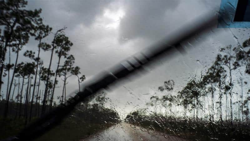
TITUSVILLE – Hurricane Dorian, the second-strongest Atlantic storm on record, pounded the Bahamian islands of Great Abaco and Grand Bahama on Sunday night and was forecast to move dangerously close to Florida in the next two days, US forecasters said.
Hazards for the Abaco Islands included storm surges 18 to 23 feet (5.5 to 7 metres) above normal tide levels, with higher destructive waves, the Miami-based US National Hurricane Center (NHC) said.
At 11 p.m. (0300) GMT, the hurricane was about 135 miles (220 km) from the Florida coast, parts of which were being evacuated, as it crawled westward. Farther north, South Carolina Governor Henry McMaster ordered mandatory evacuations for parts of eight coastal counties effective at noon (1600 GMT) on Monday.
Oh wow ? houses ? were completely destroyed In the Abaco Islands in the Bahamas. Let’s pray for all in this storm path #TheBahamas #HurricaneDorian2019 #Hurricanes #Dorian #Bahamas #242 #Abacos #HuricaneDorian ????? pic.twitter.com/sxjmjp4eZT
— ??James Julmis?? (@julmisjames) September 2, 2019
Georgia Governor Brian Kemp ordered evacuations in all or parts of six coastal counties also effective at noon on Monday.Even a glancing blow from one of the strongest storms ever to menace Florida could bring torrential rains and damaging winds, the NHC said.
“On this track, the core of extremely dangerous Hurricane Dorian will continue to pound Great Abaco and Grand Bahama islands tonight and Monday,” the NHC said.
“The hurricane will move dangerously close to the Florida east coast late Monday through Tuesday night.”Dorian is forecast to remain a hurricane for the next five days, the NHC said. Dorian made landfall on Elbow Cay in the Abaco Islands with maximum sustained winds of 185 miles per hour (295 kph) and gusts of more than 220 mph (354 kph).
Dorian was the strongest hurricane on record to hit the northwestern Bahamas as a life-threatening Category 5 storm on the five-step Saffir-Simpson Wind Scale.
It was tied with Gilbert (1988), Wilma (2005) and the 1935 Labor Day hurricane for the second-strongest Atlantic hurricane on record, based on maximum sustained winds.
Allen in 1980 was the most powerful, with 190 mph (306 kph) winds, the NHC said.Julia Eaddy, 70, in Titusville, Florida, said she and her husband had ridden out several hurricanes before and were not fazed by the forecast.
“I think it will be more of the same,” she said.
Several gasoline stations around Titusville were closed. Many grocery stores were open but boarded up. Inside, shelves emptied out fast.
Like many officials in Florida, Governor Ron DeSantis warned residents against becoming complacent after forecasts began saying on Saturday that the state might escape a direct hit.
“This storm at this magnitude could really cause massive destruction. Do not put your life in jeopardy by staying behind when you have a chance to get out,” DeSantis said, urging people to heed evacuation orders from county officials.
? source unknown
Pine bay , Freeport , Grand Bahama
Persons unknown #HurricaneDorain #HurricaneDorian2019 pic.twitter.com/OJrM8buKFY
— OluwaRob B. (@gwancool) September 2, 2019
Dozens of Floridians who live in boats in marinas in Brevard County were rushing to secure their vessels, strapping them to docks and removing canvas coverings from decks, but some boat residents said they wanted to ride out Dorian.
“I will not get off this boat during the hurricane for any reason at all, save a human life,” said Ned Keahey, 56. “It’s home.”
Residents on Abaco posted video on social media showing floodwaters halfway up the sides of single-family homes with parts of the roofs torn off. Car alarms blared across the island, which was littered with twisted metal and splintered wood.
We got this video from our Bahamian driver! This came from Abaco island, while the Eye of Dorian was passing by…@WCKitchen big damage! pic.twitter.com/nq0VWen2Cc
— José Andrés (@chefjoseandres) September 1, 2019
Forecasters predicted up to 30 inches (76 cm) of rain. The storm was moving at just 6 mph (9 kph) on Sunday night, prolonging a pummeling expected to last for hours, the NHC said.
Bahamian Prime Minister Hubert Minnis said in a nationally televised news conference that a “deadly storm and a monster storm” was battering the islands.
Grand Bahama is still feeling the impact of the Category 5 #HuricaneDorian. Based on reports out of Abaco, the devastation is unprecedented. Winds have decreased to 165MPH but Dorian remains an extremely dangerous storm. Our focus right now is rescue, recovery and prayer.
— Dr Hubert Minnis (@minnis_dr) September 2, 2019
Homes there are built to withstand winds of at least 150 mph (241 kph), but the expected storm surge was higher than the average roof.”This will put us to a test that we’ve never confronted before,” Minnis said.
“This is probably the most sad and worst day of my life to address the Bahamian people.”Palm Beach County, the third most-populated county and home to President Donald Trump’s Mar-a-Lago resort, was among those with partial mandatory evacuations.
Other counties announced voluntary evacuations.”This looks like it could be larger than all of them,” Trump said during a briefing with the Federal Emergency Management Agency (FEMA).FEMA is moving food, water and generators into the Southeastern United States, said acting Administrator Peter Gaynor.
Also on Sunday, a new tropical storm formed southwest of Mexico and was expected to become a hurricane on Monday, the NHC said.
Tropical Storm Juliette was 455 miles (735 km) from Manzanillo, Mexico, with maximum sustained winds of 60 mph (95 kph), the NHC said.


