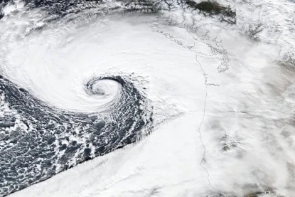
NEW YORK – A powerful bomb cyclone is set to hit the northeastern United States, bringing severe snowstorms and high winds to millions of people in its path.
The storm is expected to dump 18 to 24 inches of snow across the I-95 corridor, with wind speeds potentially reaching 70 miles per hour.
The storm, one of the most severe in recent history, poses a significant threat to over 20 million people across the region.
The extreme weather has already caused widespread disruptions, with 6,000 flights canceled and hundreds more delayed, affecting airports in cities such as New York, Boston, Philadelphia, Washington D.C., Baltimore, and New Jersey.
In total, nearly 7,000 flights have been impacted so far.
The National Weather Service has issued emergency warnings in six states, urging residents to stay alert and prepare for hazardous conditions.
Snowfall is predicted to reach up to 24 inches in New York, Boston, and Philadelphia, while Washington D.C. and Baltimore may receive 5 to 8 inches of snow.
Additionally, some areas in New Jersey are expecting more than 2 feet of snow.
The storm’s impact stretches over 600 miles, with 29 million people now under severe warning.
Authorities are advising residents in affected areas to exercise extreme caution as the storm is predicted to paralyze life in the region. With global attention focused on the storm, it is expected to go down as one of the most unforgettable weather events in the region’s history.


